


Maps & Trails
The Neilson Spearhead Nature Preserve offers more than 400 acres of protected forest, wetland, and lake shoreline. Our network of trails invites you to explore diverse habitats, from towering pines and hardwoods to open bogs and lakeshore views, while discovering the birds, wildlife, and quiet beauty the preserve protects.
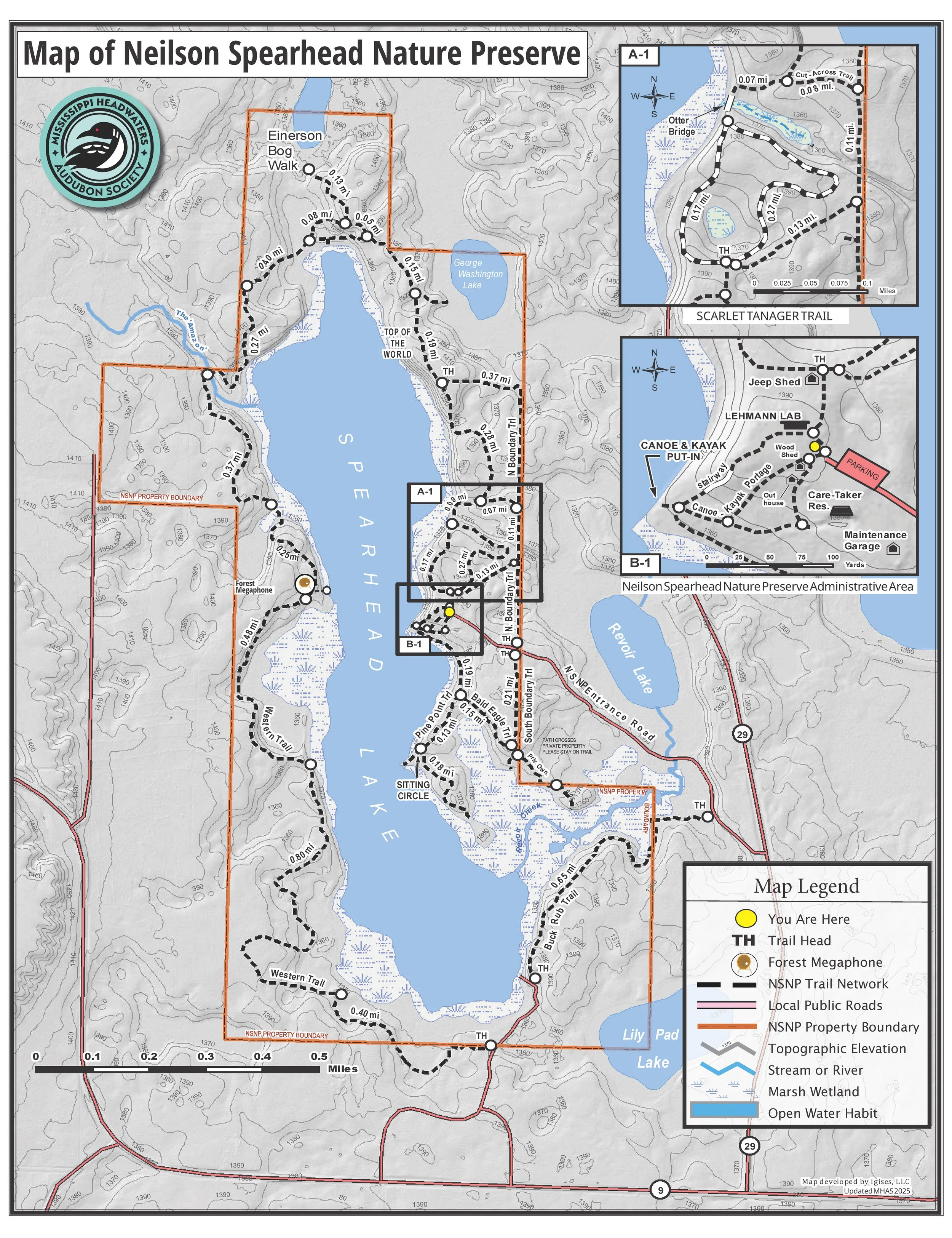
Trail Map
For the best experience, download our trail map. The map shows trail routes, key features, parking areas, and points of interest. Please be aware, phone and wireless coverage is not guaranteed throughout the preserve.
Trail Etiquette & Preserve Guidelines
To help protect the Preserve and its wildlife:
Stay on marked trails at all times.
Dogs must be leashed.
Motorized vehicles are not allowed.
Carry out all trash and leave no trace.
Observe wildlife from a distance.
Your care helps keep the habitats safe for birds, plants, and all the creatures calling the Preserve home.
Seasonal Notes & Accessibility
Trails range from easy to moderate difficulty. Natural surfaces may be uneven or wet, especially after rain or snow.
Winter visitors are welcome to snowshoe or hike; dress for weather and trail conditions.
Some trails or facilities may be temporarily closed due to maintenance or storm cleanup. Check our News & Updates for the latest information.
How to Support the Preserve
Our environmental programming, and infrastructure are maintained by volunteers and supported by members of the Mississippi Headwaters Audubon Society.
Your membership, donations, and volunteer efforts make it possible to offer environmental educational programming and continued care for this unique landscape.
